Latest News
-
Hungary's Paks Nuclear Plant will shut down one reactor due to a drop in the Danube water levels
Operator MVM announced that the Paks nuclear plant in Hungary will shut down one of the 'four reactors' at a time of?1300 GMT on Wednesday due to record low water levels along the Danube River, which provides cooling water for the facility. On Monday, the plant had already cut output by 254 Megawatts at another unit. The plant operates four Russian-built nuclear reactors with a combined 2 gigawatts of capacity. It produces almost?half of Hungary’s electricity. The shutdown on Wednesday will reduce production to?about 60 percent of its capacity. It follows?contingency steps taken in June, during a heatwave record. Authorities exempted this plant from temperature limits for discharged cooling waters. The water levels along the Danube are now at new record lows. This has disrupted cargo and river cruises on one of Europe's most busy?waterways. The Environment Minister Laszlo Gajdos stated earlier on Wednesday that the Hungarian water management authorities are ready to assist in ensuring cooling water supplies for the plant. He said that the authorities had placed four pumping pontoons, and two floating cranes near Paks in preparation for a possible deployment as water levels are expected to continue to drop over the next few days. Reporting by Gergely szakacs and Anita Komuves. Mark Potter edited the article.
-
NextEra and Brookfield plan a $100 billion Kentucky datacenter campus
NextEra Energy and Brookfield are building a $100 billion campus of data centers at an 'ex-uranium enrichment site' in Paducah, Kentucky. The soaring demand for electricity in the United States is driving companies to invest heavily into artificial intelligence data centres and other technologies that strain an aging U.S. electric grid. NextEra is the largest U.S. power company and will provide 2.6 GW in battery storage and 2 gigawatts (GW) of natural gas to support the datacenter. Brookfield, on the other hand, will own and operate the 1.8 GW campus. One gigawatt can power approximately 750,000 homes. The campus will be built on the Department of Energy’s Paducah Site. This site was originally constructed in 1952 for the production of enriched uranium, but it was closed down later. NextEra said the project complies with the Trump Administration's "Ratepayer Protection Pledge" which seeks?to ensure that companies building and using data centres?pay over?and above normal rates to avoid costs being passed on to average households. Brookfield CEO Bruce Flatt said in a statement that "the Department of Energy Paducah Site will be the seed of a plan to invest 100 billion dollars?in AI Infrastructure". The project should be completed in 2032. Reporting by Vallari Shrivastava, Bengaluru. Editing by Tasim Zaid
-
Allied Gold's $4 Billion sale to China's Zijin falls through, lands a $295 M investment
Zijin Gold & Allied 'Gold has scrapped its planned C$5.5 Billion ($3.90 Billion) buyout. Instead, the?Chinese?company took a 9.2% share for around $295 M. In premarket trading, shares of Allied Gold listed in the U.S. fell by nearly 15%. The companies announced on Wednesday that they had mutually agreed to allow the deadline of July 29 to expire as "there was no reasonable likelihood" that the remaining conditions would be met in a reasonable time frame. Allied also cited broader external factors affecting trans-border transactions at this scale but did not provide any further?details. Zijin Gold operates mining operations in Asia, Africa and South America, while the Canadian firm has gold mines,?development and development projects on the Ivory Coast, Mali, and Ethiopia. In January, Zijin announced its agreement to purchase Allied for C$44 a share. ZIJIN?REMAINS INVESTOR Zijin has agreed to purchase approximately 12.8 million newly-issued Allied shares for?C$32.55 each in a private placing for the '9.2% stake. The transaction is expected to close around August 10. Allied stated that it 'expects' to use the proceeds - including the completion and ramping up of the Kurmuk Mine in Ethiopia and the expansion of the Sadiola Mine?in Mali - to advance growth initiatives. It also said they expect the proceeds -including increasing production – at their Ivory Coast operations, and funding exploration across the business. ($1 = 1.4098 Canadian dollars) (Reporting by Arunima Kumar in Bengaluru; Editing by Vijay Kishore)
-
S&P says El Nino is unlikely to affect ratings for the time being
One of S&P Global’s top analysts said that El Nino will not 'by itself' lead to sovereign ratings downgrades, unless it is significantly worse than expected and governments take costly measures to support the affected countries. Joydeep Mukherji is S&P's Latin America lead ratings analyst. She said that the rating impact would be determined by the severity of the droughts and flooding caused by a potential "super" El Nino, as well as how policymakers handle the fallout. Mukherji stated in an interview that "if it's a flood or a dry spell that disrupts economic activity, then you assume?it will pick up within six months, twelve months." If that's the only thing that happens, ratings should be able?to withstand that kind of stress." The key factor is more likely to be the response of the governments in the hardest-hit countries. Mukherji stated, "If there is a small fiscal intervention to help those affected by the crisis, then that's a good thing." However, broader measures like a control on fuel or electricity prices could increase fiscal pressures. He said: "Suddenly, you've got a fiscal issue on the side. Not just the disruptions caused by natural disasters." The government faces a difficult choice: either they allow a part of the cost to be borne by businesses and households, or they take on a greater share through increased public spending, larger deficits, and more borrowing. He said that policy response was key. "Do governments share or spare the costs or do they take it all on themselves in their balance sheet by increasing deficits and debt?" He said that countries with flexible exchange rate may be better able to absorb weather-related shocks. As examples, he cited Colombia and Peru as two countries where economic impacts could be "substantial". The 'political tools' available to maintain competitiveness in a country without its own currency, such as Ecuador with the dollar, are fewer. S&P does not expect El Nino will trigger a negative rating wave. He warned that there is still a lot of uncertainty about the magnitude of the phenomenon.
-
EU: Wildfires moving east threaten Italy and Greece
Greece, Italy and Central Europe will face increased 'wildfire' risk in the next few weeks. This is despite the fact that wildfires are still raging in Spain and France. Maria Zuber, the head of EU's Emergency Response Coordination Centre said that the heatwave would make the next few days "very difficult" for France. She also warned other countries to prepare themselves for "imminent disasters". Zuber told reporters that the next danger was already moving towards Greece and Central Europe. "Greece was spared for the moment, but now we know that it is going to Greece. "Italy faces risk at the start of August. We will need to see what will happen with the Iberian Peninsula because if it is there too, we'll have all Europe on blaze," she said. The forecast includes weather conditions that can help fires spread quickly, including high temperatures, dry, windy air and lack of rain. Climate change intensifies the hot and?dry conditions, which allow wildfires spread more quickly. Last year, Europe experienced its worst wildfires season ever. More than a million acres of land were burned. Zuber stated that Europe's fire situation so far this year was similar. She said, "We could be on the verge of another record." The EU centre coordinates?the deployment of aircraft and firefighters in countries that need emergency assistance, utilizing?resources pooled and rented by European countries. The EU centre has sent seven planes, four 'helicopters' and three 'ground firefighting teams to Spain and France. Zuber explained that not all aircraft in the EU fleet were currently in use. Some of them are already pre-stationed to be ready for deployment in Eastern and Central Europe, where the threat is increasing. (Reporting and editing by Alison Williams; Kate Abnett)
-
"There's nothing Left": French wildfire victims return to their burned homes
Raphael Fohanno was shocked to see that his parents' house was reduced to a smouldering cinder. The 18-year old said: "Right here was the livingroom; the sofa was in the corner, the TV, a coffee-table, a vase and the printer. Everything was there." She was looking at the charred wood and mangled steel of the home that the family had lived in for the past seven years. It's brutal. The worst part is feeling helpless. "It's horrible for me to think that I can't help with anything, not even my pets." His parents, sister and other family members were evacuated via helicopter while he was out. His parents have returned to Biscarrosse already to check on the damage. "It is a shock, to think that only an hour ago I was in my bedroom and had everything, and now there's nothing." Fohanno said, "It's really sad." MEMORIES FUMED UP IN SMOKE A fire that started on Thursday began last week in Biscarrosse. The town has a population of 14,000 and is located 40 km south of the Cap Ferret peninsula. Residents have slowly been allowed to return to certain neighbourhoods after being evacuated. This included a children's camp and an aged care home. France is experiencing a wildfire season unlike any other. Around 220,000 people have been forced to leave their homes, in what President Emmanuel Macron called the worst wildfire crisis in France since World War Two. The temperatures will rise on Wednesday and create more volatile conditions. On Tuesday, Interior Minister Laurent Nunez stated on X that it took 550 firemen and 450 officers to put out the Biscarrosse blaze. Beatrice Dubaquier discovered that her house had been destroyed when she returned to it on Sunday evening. Her family searched through the debris and found broken pieces of crockery. A mug had been given to her as a gift for a birthday, a dish was given to her and 'her husband at their wedding. Dubaquier described her emotions as being on a rollercoaster. Lucie, her daughter, recalled her younger sister's first steps and first words in the home. Lucie said, "It was pretty difficult to see all those memories burn up." (Written by Elizabeth Howcroft, edited by Gabriel Stargardter & Alison Williams).
-
Profit growth for the Morning Bid AMERICAS - US
What's important in the U.S. and international markets today by Mike Dolan Editor-at-Large of?Finance and Markets As a stark example of how difficult it is for Big 'Tech to impress the markets, South Korean chip maker SK Hynix fell again on Wednesday morning after a six-fold increase in quarterly profits?missed expectations. This is a warning before the?release of U.S. megacaps earnings later today. The markets will first digest Kevin Warsh's comments and the Federal Reserve Chair's policy announcement as he speaks on the podium today. Below, I'll go into more detail. Check out my midweek column where I discuss hyperscalers' cash burn, the new British Prime Minister's poll surge and whether the Ukraine war and the Iran war could converge. Listen to the Morning Bid podcast. Subscribe to the Morning Bid daily podcast and hear journalists discussing the latest news in finance and markets seven days a weeks. US PROFIT GROWTH MUSHROOMS SK Hynix plunged nearly 10% in the early hours of Wednesday, dragging down the chip-heavy KOSPI by as much as 12,6%. Index pared losses and closed down 6%. It is now at levels seen last in early April. Samsung will also report this week. The tremors in South Korea have created a more tense environment for investors, as they await Microsoft and Meta's earnings after the bell today. Alphabet, Tesla and other companies have raised alarms with their AI capex. Investors will be watching closely for cash burn and leverage. According to LSEG, the 'overall U.S. earning picture is still a ballooning one. Estimates for the annual aggregate S&P500 profit growth through the 2nd quarter are now a whopping 39 percent - which is more than 10 points above estimates made at the beginning of the month. But before we move on to earnings, the Fed's decision is one of the most uncertain in recent years. Deutsche Bank says that the market is split by a one in three chance of an increase in interest rates, which has been priced into futures. This is the highest level of uncertainty the market has seen before a Fed meeting. The Fed's hopes for a more clear picture of the energy markets after this week’s drop in oil prices were dashed overnight when the tension in the Iran conflict broke. The global crude price rose to over $87 per barrel. Washington announced on Tuesday it had carried out strikes in Iraq with Saudi Arabia against groups aligned to Iran, and intercepted Iranian rockets launched at U.S. bases. Chart of the Day Despite a surge in corporate profits and optimism over AI spending by U.S. companies, U.S. consumer sentiment is still relatively low. The Conference Board's consumer confidence index fell to 90.8 in July from 92.2 last month, contrary to expectations of economists. This month's high energy prices played a role, but also the percentage of consumers who viewed jobs as "plentiful". It has fallen to its lowest level since Febuary 2021. Watch today's events * Fed announcement of interest rate (2 p.m. ET) and press conference at 2:30 p.m. * U.S.?corporate earnings Meta, Microsoft * U.S. 2-year floating rate note auction (11:30 ?a.m. EDT) Want to receive Morning Bid every morning in your email? Subscribe to the newsletter by clicking here. Follow us on LinkedIn, X and ROI. The opinions expressed by the author are their own. These opinions do not represent those of News. News is bound by the Trust Principles to maintain integrity, independence and freedom from bias. (By Mike Dolan).
-
Valterra profits soar on rising prices as AI drives future platinum demand
?Valterra Platinum, a South African miner, expects that?AI --?and data centres needed to drive it -- will propel demand for Platinum Group Metals (PGM), said CEO Craig Miller on Wednesday. The company had reported a 17 fold increase in its half-year profits. Valterra, world's largest platinum producer in terms of value, has reported headline earnings per shares of 82.02 Rand ($4.9) in the six-month period ending June 30. This is up from 4,73 rand?a year ago, mainly due to an 85% increase in metal prices and an 18% rise in sales volume. Electric vehicles, which do not need to control emissions, are threatening the future of PGMs. The recent massive growth of AI has created a new growth path. AI-DRIVEN DEMAND FOR PGM Valterra believes that there will be a?potential demand for PGM of 10 million ounces per year in industrial applications, jewelry, the growth of Hydrogen as a source of clean energy as well as supporting AI technology. Miller said in an interview that there is a real demand of about 2 million ounces. "We are actively working with a high level of confidence to meet this demand," Miller stated. "AI wasn't necessarily on our radar 24 month ago." What 'we are seeing, however, is that PGM is being used in AI-related activities, and we estimate the demand to be between 200,000 to 400,000 ounces. Miller stated that the demand for PGMs based on AI could increase by as much as five times by 2030. For the fourth consecutive year, global platinum supply is expected to be less than demand, with about 7 million ounces. According to the World Platinum Investment Council, PGMs are a good choice for the AI industry because of their exceptional electrical, thermal, and catalytic qualities. Miller stated that PGMs can also replace about 10% of gold used for electroplating, and other electronic applications. This could create a demand for a further 1 million ounces PGMs per year. Valterra announced that it would pay an interim dividend per share of 57 rand, up from 2 rand, representing a payout ratio of 70%. This represents a return to shareholders of 15.1 billion rand.
NHC: Erin is now a Category 5 Hurricane
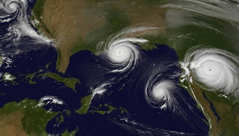
The U.S. National Hurricane Center announced on Saturday that Hurricane Erin has now become a Category 5 hurricane.
The storm was located about 175 miles (280 km) north of San Juan in Puerto Rico. Maximum sustained winds were 160 mph.
Erin was forecast to turn west-northwest Saturday night, slow down its progress and then turn northwards early next week. On Monday, a slow weakening is expected to start.
Erin is expected to continue strengthening into the next week, according to previous statements by NHC.
On Sunday, the hurricane's centre was predicted to move eastwards to the Turks and Caicos Islands and southeastern Bahamas, and then pass north of northern Leeward Islands and Puerto Rico.
The NHC stated that Erin's swells will continue to affect the Virgin Islands and Puerto Rico as well as parts of the Turks and Caicos Islands and northern Leeward Islands over the weekend.
It said that the swells would spread to the Bahamas and Bermuda early next week.
The Bahamas, who provide some meteorological services to the Turks and Caicos Islands provided a Tropical Storm Watch in the British Islands located southeast of the Bahamas.
Erin also raises concerns about wildfire risk if sparks caused by humans ignite parched vegetation, and strong winds fan the fires. BMS Group Senior Weatherologist Andrew Siffert stated that these conditions may arise if Erin becomes a powerful storm offshore fueled by colliding cold and warm air instead of tropical seas. Twelve Securis, an insurance-linked securities manager, said that Erin would remain offshore enough to avoid significant impacts on the U.S. East Coast.
The NHC stated that Erin will produce heavy rains through Sunday in the northern Leeward Islands as well as the Virgin Islands and Puerto Rico.
(source: Reuters)